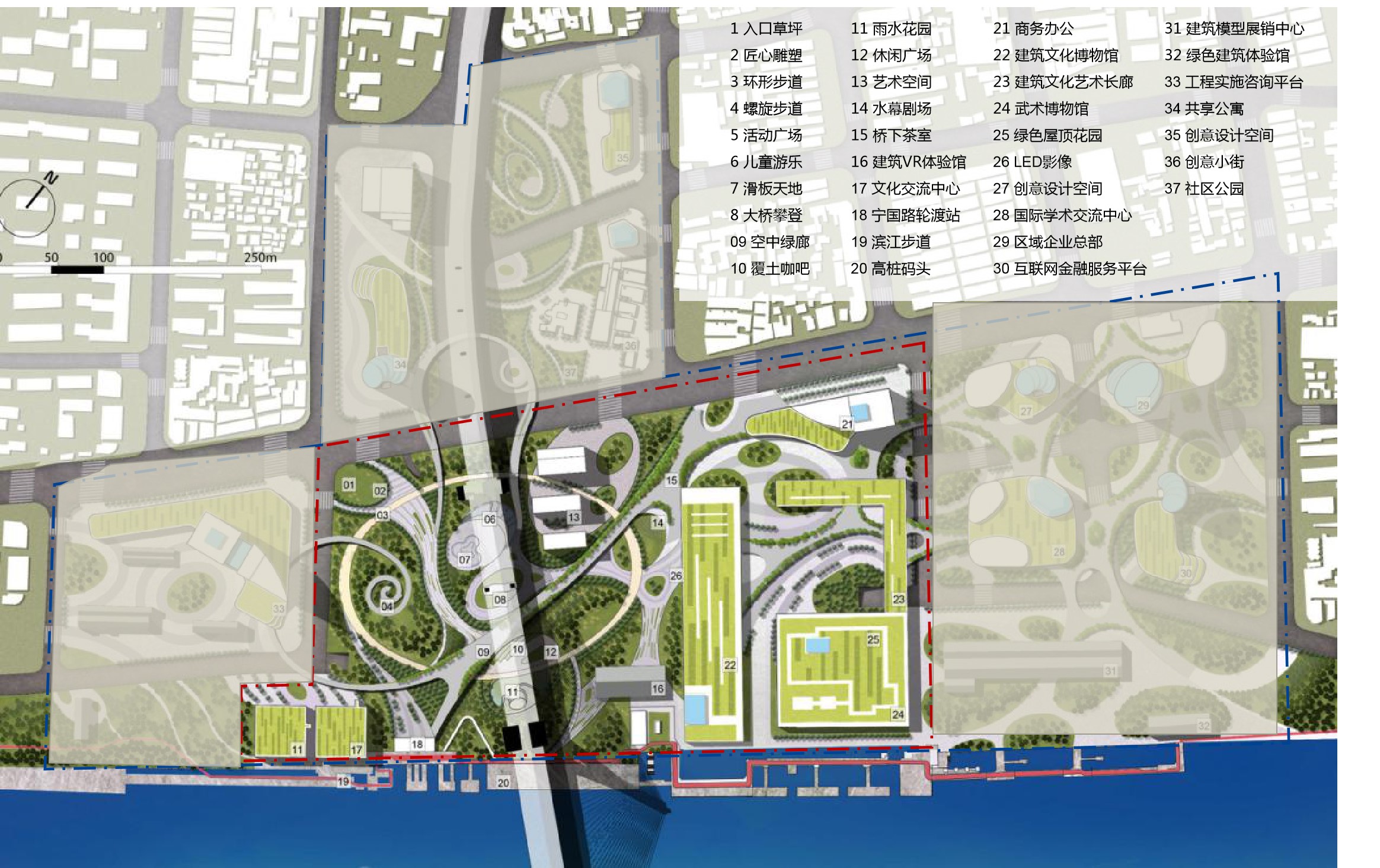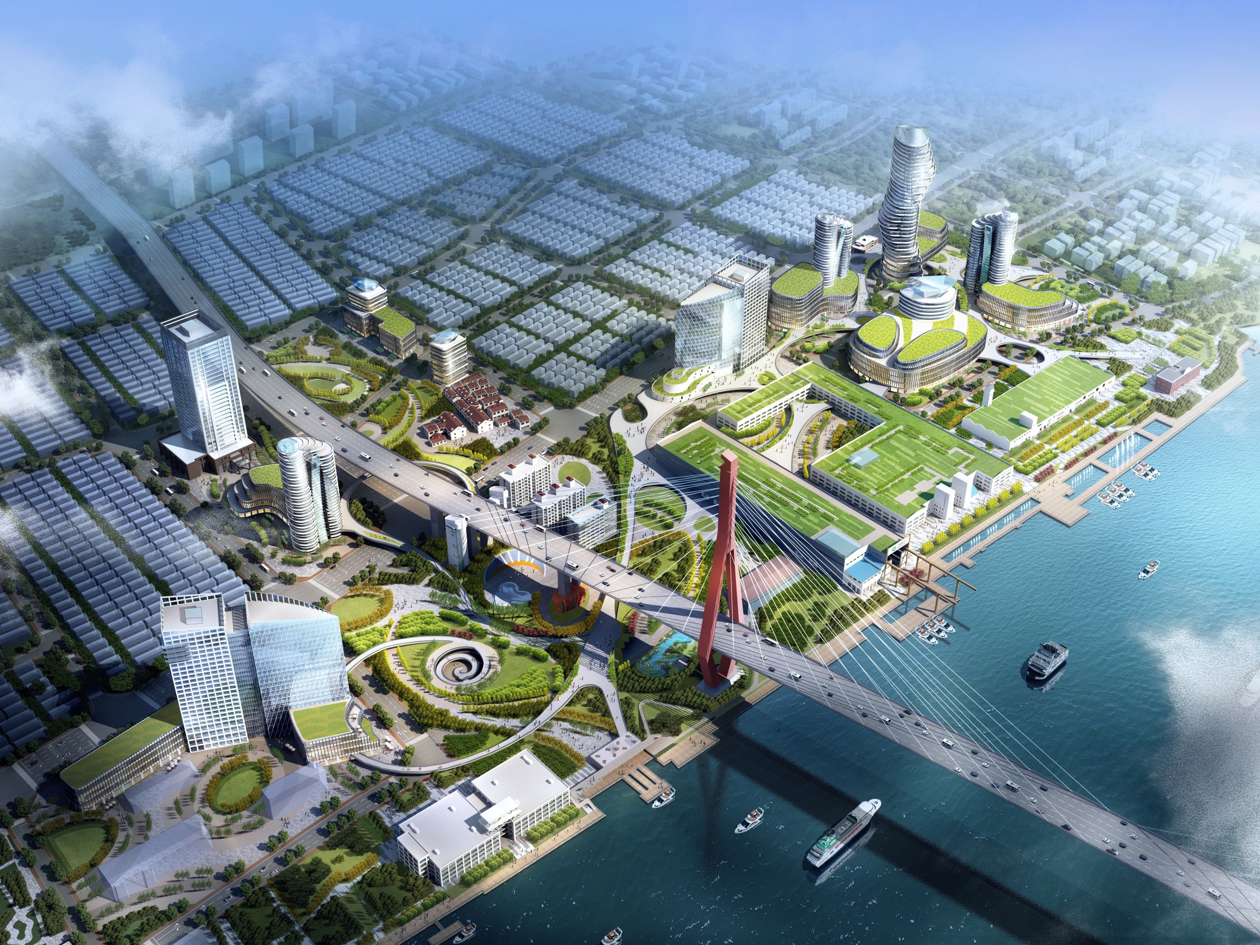
Comprehensive Development Implementation Plan for Yangpu Riverside Yangpu Bridge Area
Project location
Yangpu District, Shanghai

Project scale
The planning area is 50 hectares and the detailed design area is 20 hectares
1. Integration of architectural culture and landscape
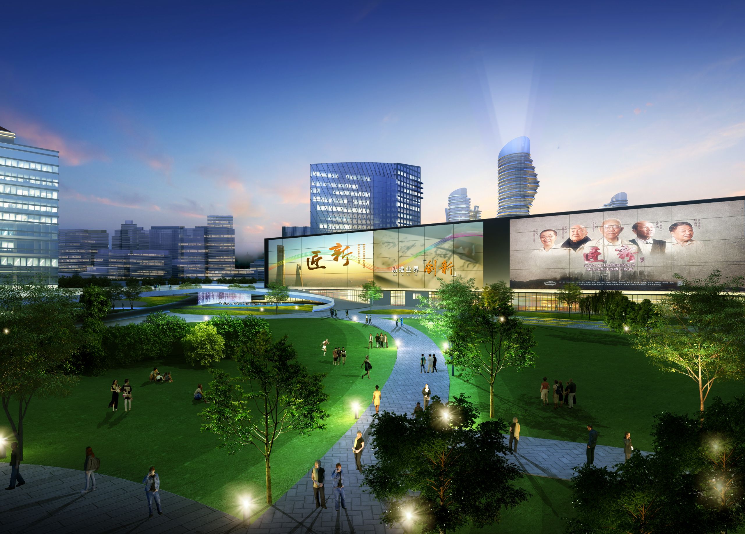
Study and analyze the current building quality, spatial scale, technical art and cultural value, and rely on historical preserved buildings to place them in architectural culture bearing areas such as "Architectural Culture Exhibition Center, International Architectural Design Exchange Platform, and China International Architectural Design Award (Golden Innovation Award)". Transform the facades of historical buildings, integrate modern architectural language, and show the unique industrial style of Binjiang; green the roofs of some historical buildings to make them Binjiang viewing platforms, and architectural culture and landscape complement each other.
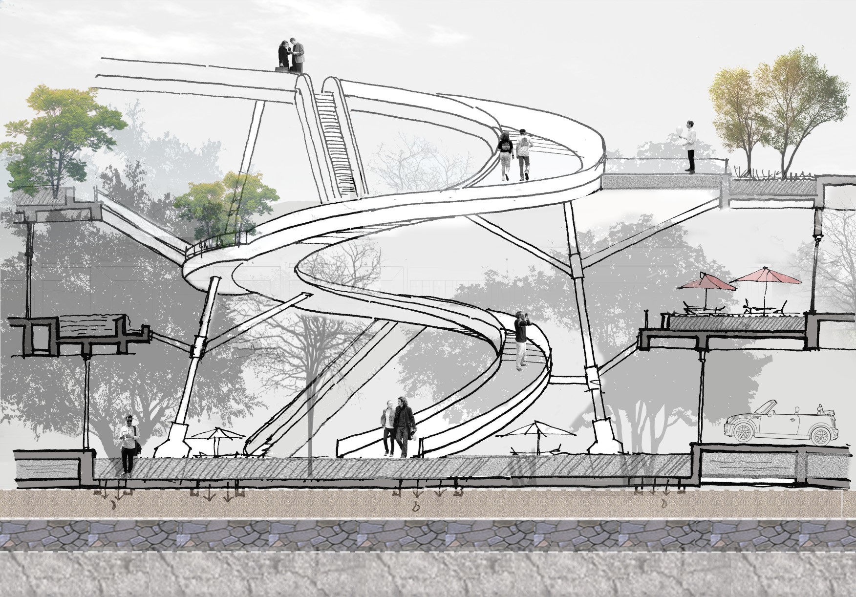
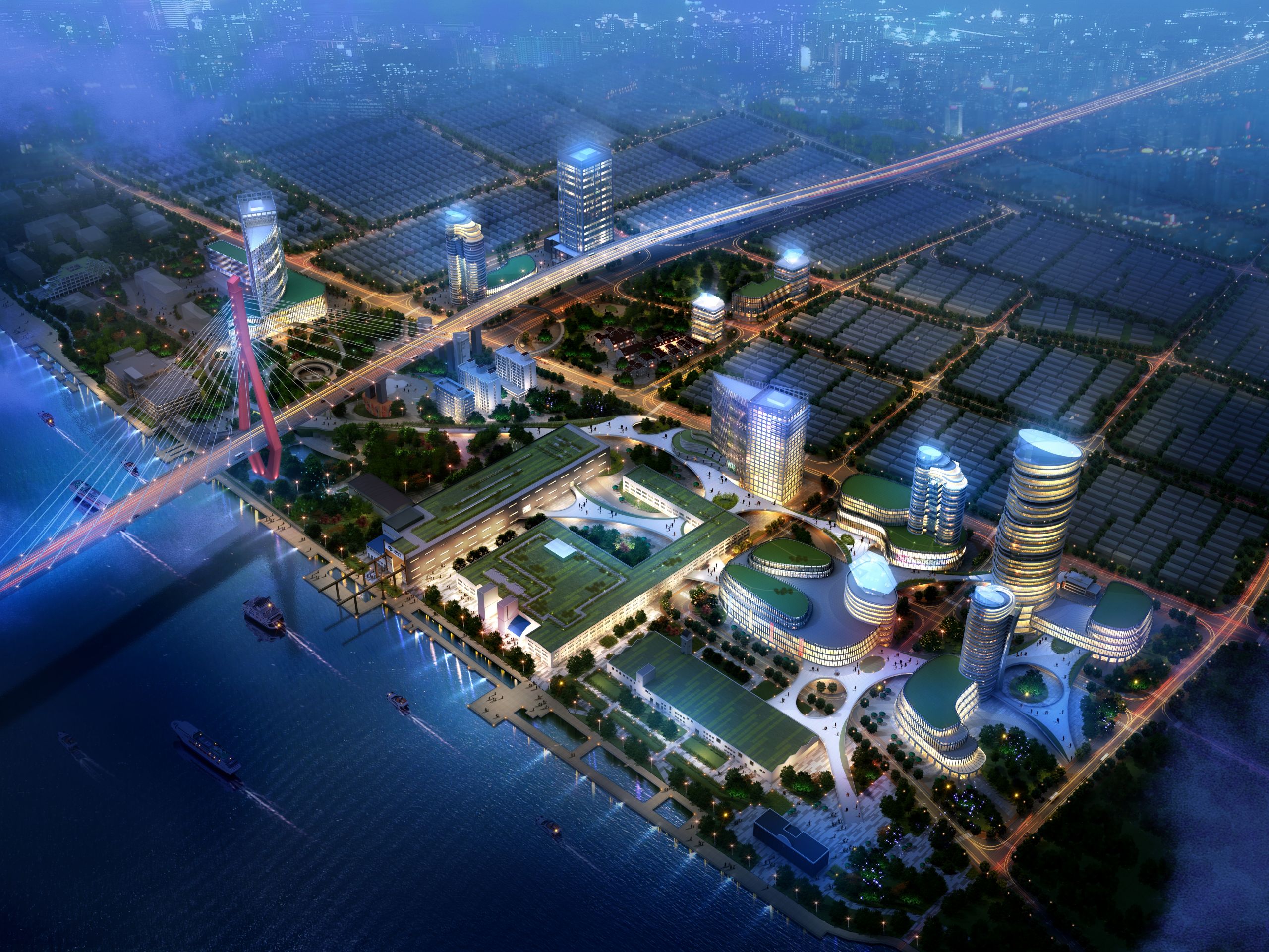
2. Three-layer space interconnection and sharing
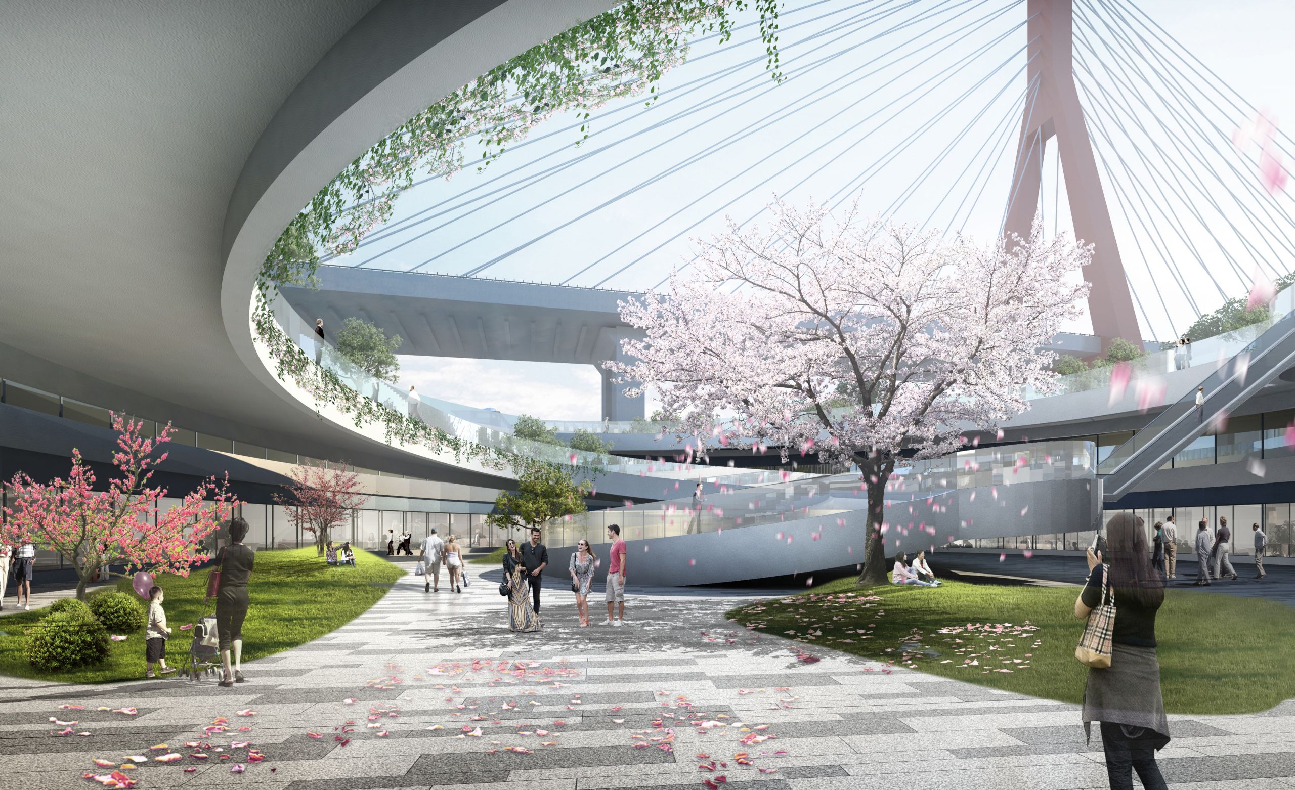
Through the construction of the underground, ground and above-ground three-layer pedestrian system, the contradiction of pedestrian crossing is effectively solved, and the interconnection of various functional areas is realized; at the same time, the three-layer shared linkage space not only enriches the complex functions and landscape experience of Binjiang, but also enhances the value of the land, and realizes the multi-level dialogue and integration of history, modernity and Pujiang.
3. Comprehensive coordination and sharing of bus network
The optimization of transportation facilities and slow-moving roads greatly guarantees the integrity of the bridge park and the creation of natural ecology.
The travel structure dominated by public transportation moves the first and last bus stops to the underground space, forming a seamless connection between water and land transportation facilities, and truly realizing green travel; the spatial solution system with pedestrian transportation as the core meets the maximum ecological green space on the ground floor, and the second floor space realizes the connection of various functional areas and three riverside roads; the local road network is semi-underpassed (part of Anpu Road), and the spatial texture of the auxiliary machine plant is completely preserved to achieve the integration and interconnection of the protected buildings and the road network system;
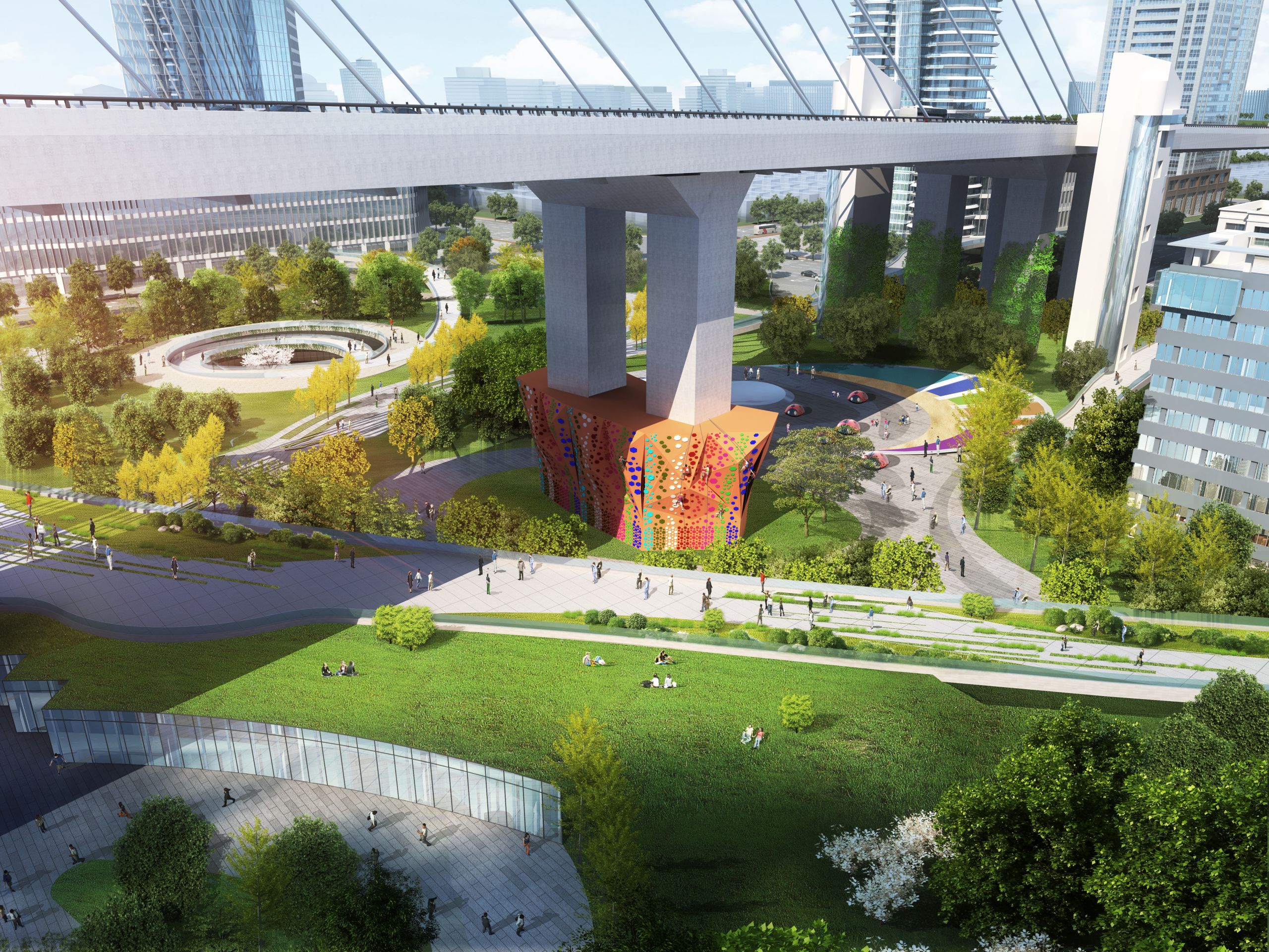
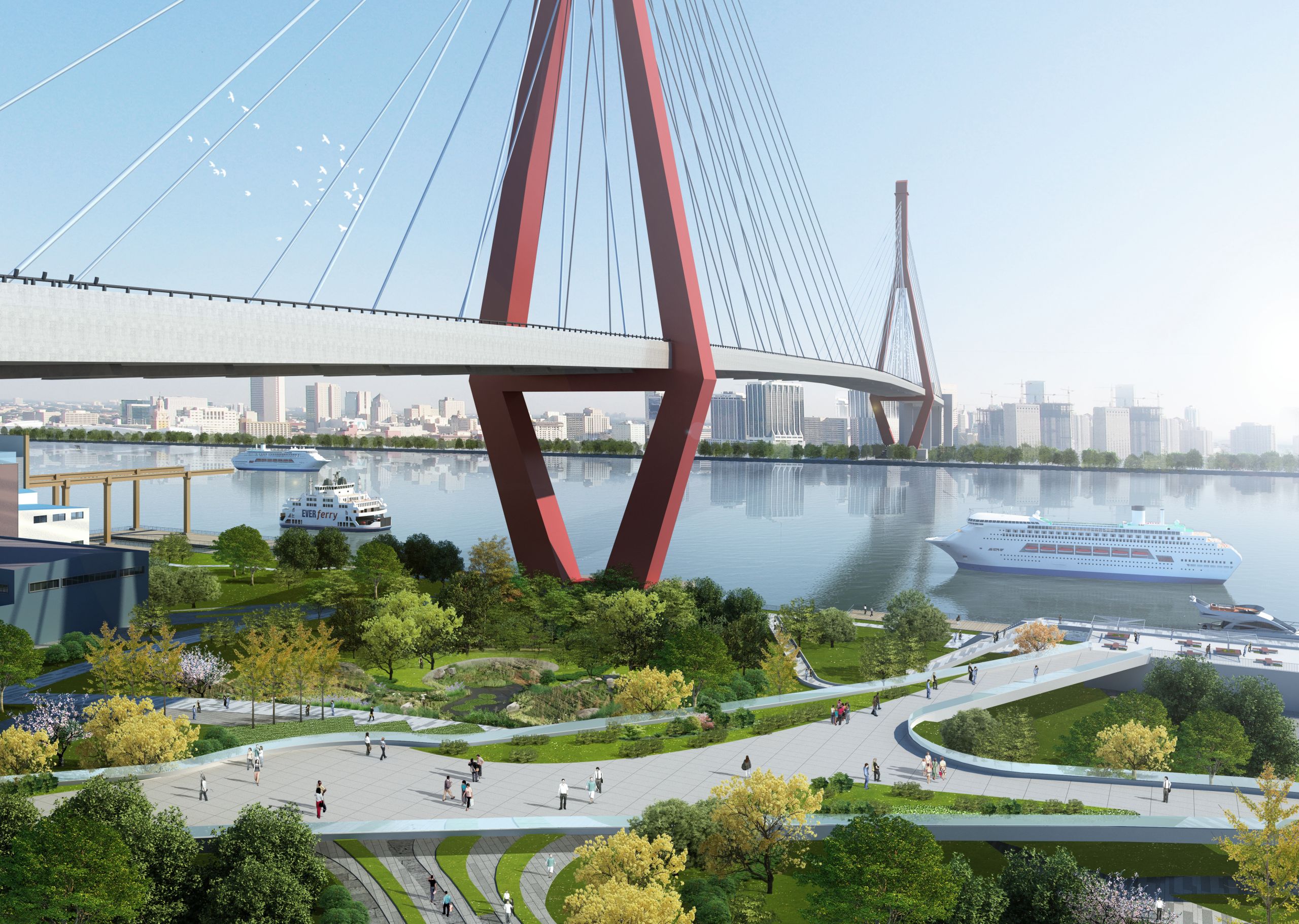
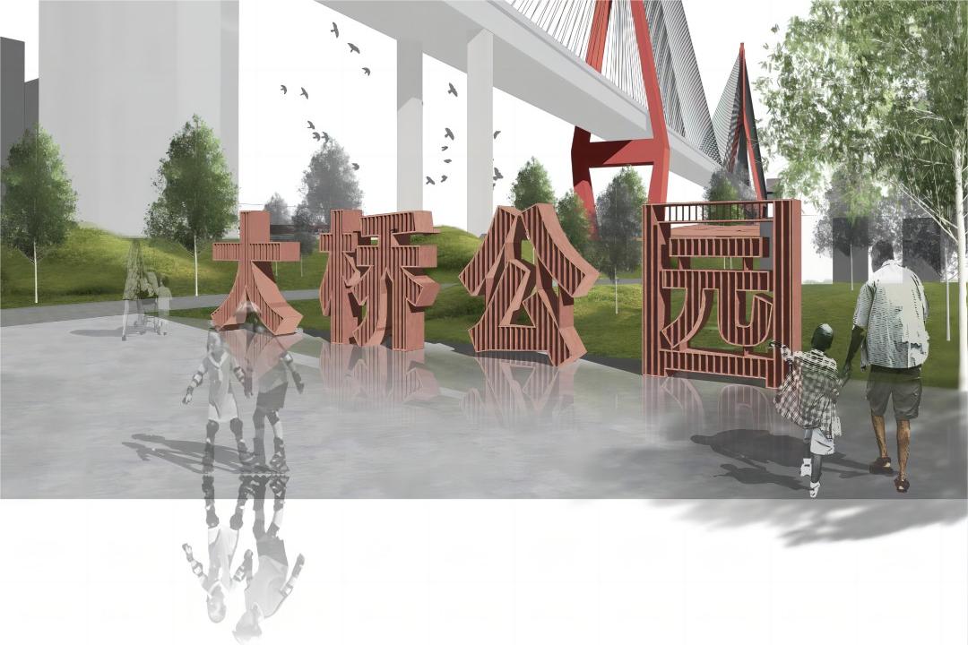
4. Symbiosis of nature and humanities in park landscape
In view of the key problems of low utilization rate of waterfront resources, insufficient green volume, and misplaced use of space under the bridge in Daqiao Park, the landscape design adopts a low-carbon, energy-saving, and intelligent sustainable development strategy: multi-dimensional three-dimensional and multi-layer planting to increase green volume; build multi-interface rainwater gardens (combined with municipal roads, park sites, and buildings); use more low-maintenance plants to create a plant landscape close to natural forests; multi-means to adjust the microclimate and shape the micro-topography of the space under the bridge.
Study and analyze the current building quality, spatial scale, technical art and cultural value, and rely on historical preserved buildings to place them in architectural culture bearing areas such as "Architectural Culture Exhibition Center, International Architectural Design Exchange Platform, and China International Architectural Design Award (Golden Innovation Award)". Transform the facades of historical buildings, integrate modern architectural language, and show the unique industrial style of Binjiang; green the roofs of some historical buildings to make them Binjiang viewing platforms, and architectural culture and landscape complement each other.
2. Three-layer space interconnection and sharing
Through the construction of the underground, ground and above-ground three-layer pedestrian system, the contradiction of pedestrian crossing is effectively solved, and the interconnection of various functional areas is realized; at the same time, the three-layer shared linkage space not only enriches the complex functions and landscape experience of Binjiang, but also enhances the value of the land, and realizes the multi-level dialogue and integration of history, modernity and Pujiang.
3. Comprehensive coordination and sharing of bus network
The optimization of transportation facilities and slow-moving roads greatly guarantees the integrity of the bridge park and the creation of natural ecology.
The travel structure dominated by public transportation moves the first and last bus stops to the underground space, forming a seamless connection between water and land transportation facilities, and truly realizing green travel; the spatial solution system with pedestrian transportation as the core meets the maximum ecological green space on the ground floor, and the second floor space realizes the connection of various functional areas and three riverside roads; the local road network is semi-underpassed (part of Anpu Road), and the spatial texture of the auxiliary machine plant is completely preserved to achieve the integration and interconnection of the protected buildings and the road network system;
4. Symbiosis of nature and humanities in park landscape
In view of the key problems of low utilization rate of waterfront resources, insufficient green volume, and misplaced use of space under the bridge in Daqiao Park, the landscape design adopts a low-carbon, energy-saving, and intelligent sustainable development strategy: multi-dimensional three-dimensional and multi-layer planting to increase green volume; build multi-interface rainwater gardens (combined with municipal roads, park sites, and buildings); use more low-maintenance plants to create a plant landscape close to natural forests; multi-means to adjust the microclimate and shape the micro-topography of the space under the bridge.