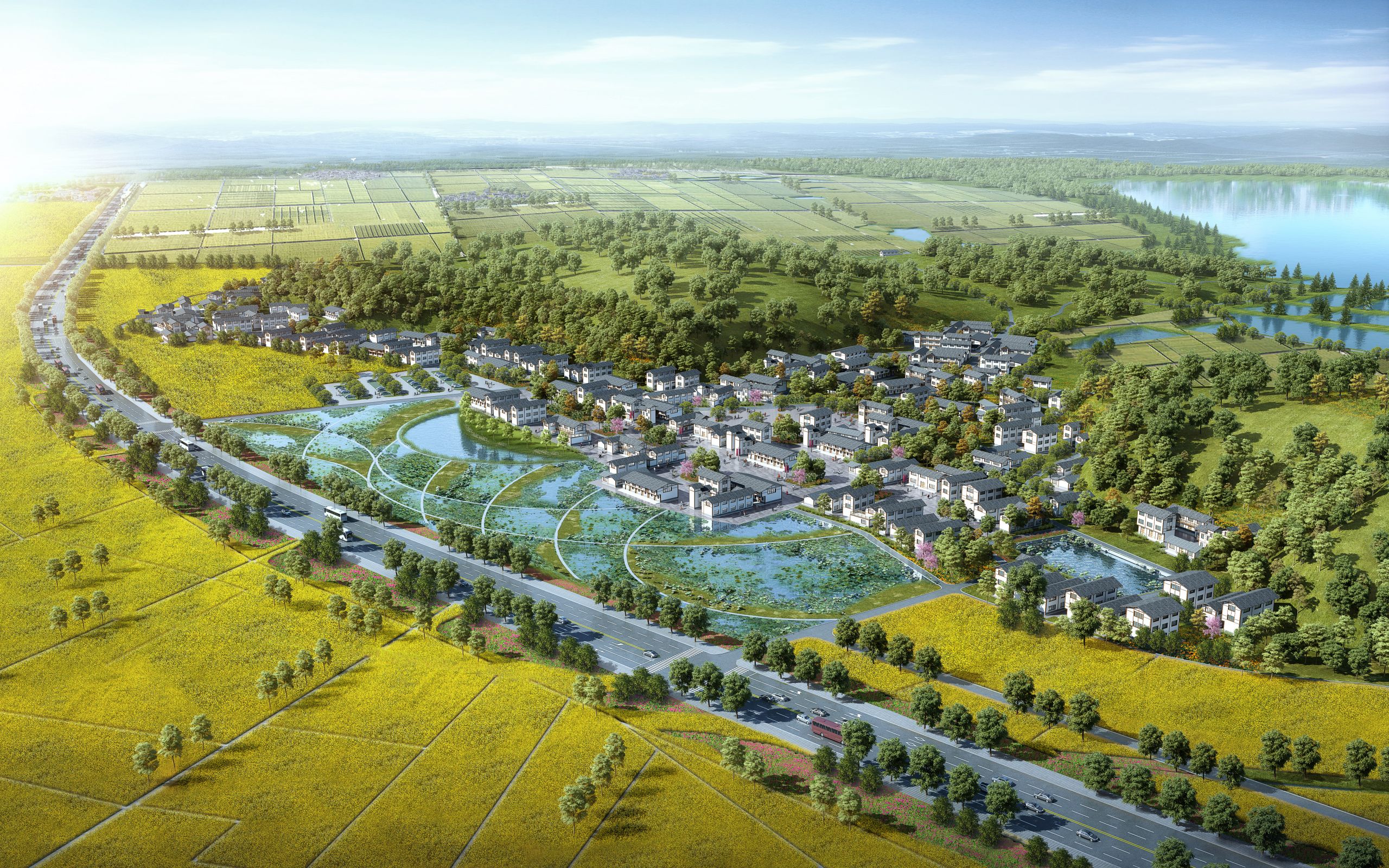
Yunnan Kunming Jinning District Lakeside Planning and Construction Project
Project location
Kunming, Yunnan Province

Project scale
Planned area:1142 hectares
The project is located in Jinning District, Kunming City, close to the city and transportation hub, with convenient transportation. The project site is adjacent to Dianchi Lake, closely connected with Xishan Scenic Area and Ancient Dian Kingdom Scenic Area, and they influence and complement each other.
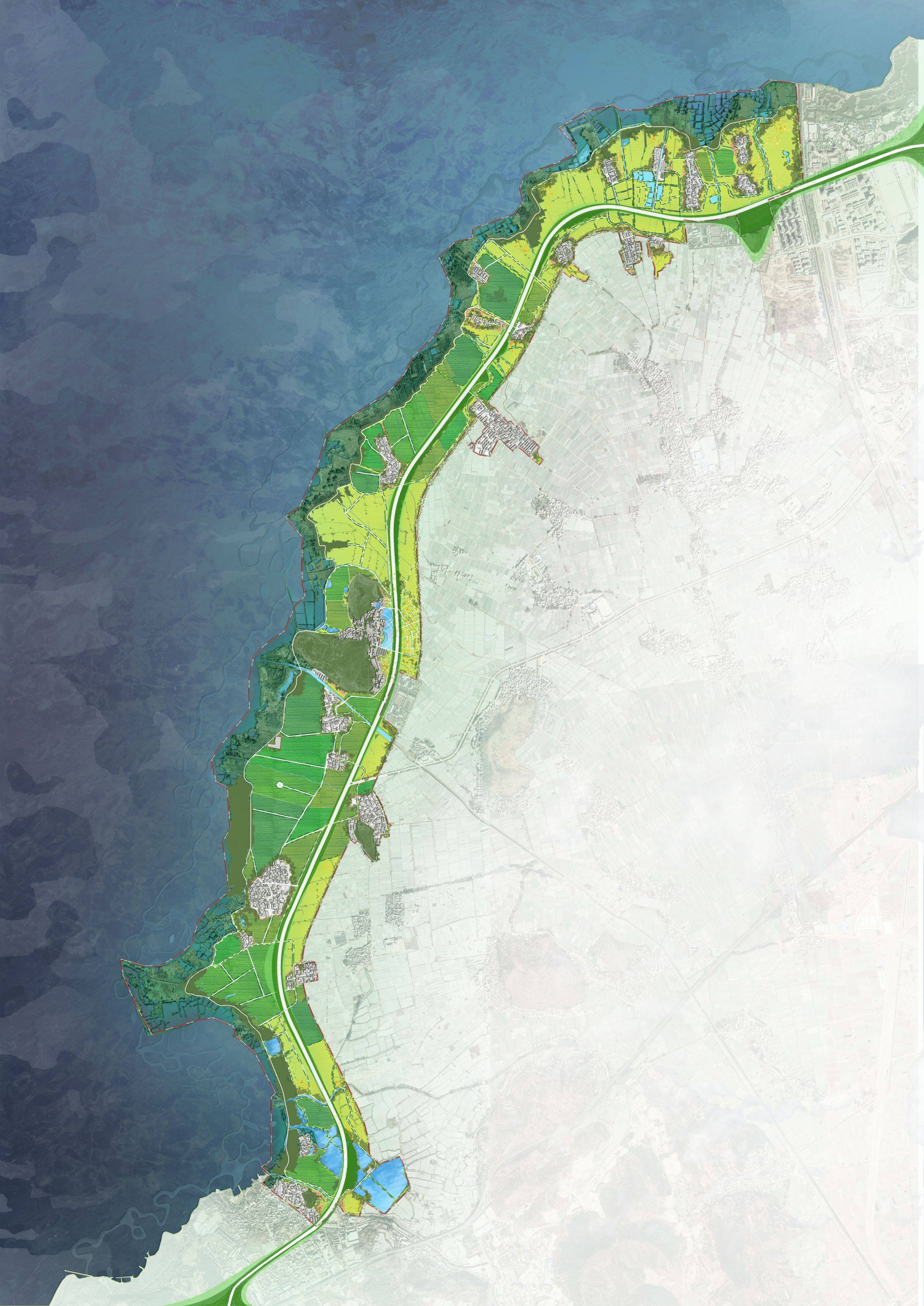
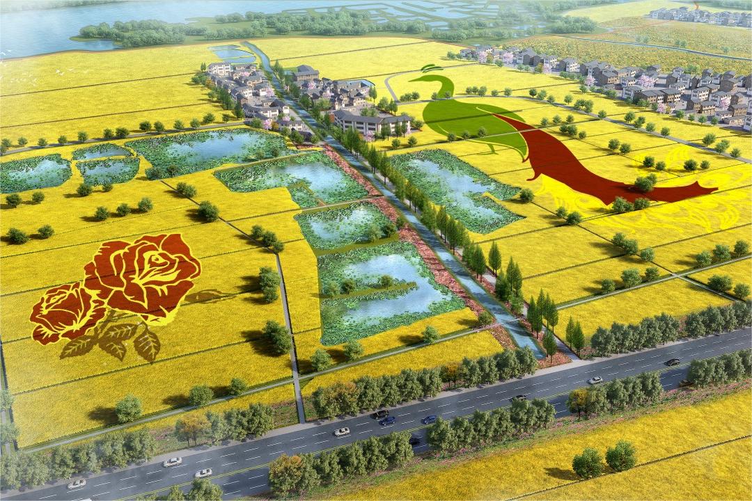
The planning scope covers about 11.1 kilometers along the Huanhu Road on the south bank of Dianchi Lake in Jinning District, with a total planned area of about 1,142 hectares (17,130 mu); the resettlement land is located on the west side of the Yu Ni River in Xinjie District, Jincheng Town, with a total area of about 152 hectares (2,280 mu).
[Highlights of the plan]
1. Prioritize ecological protection and build an ecological security pattern
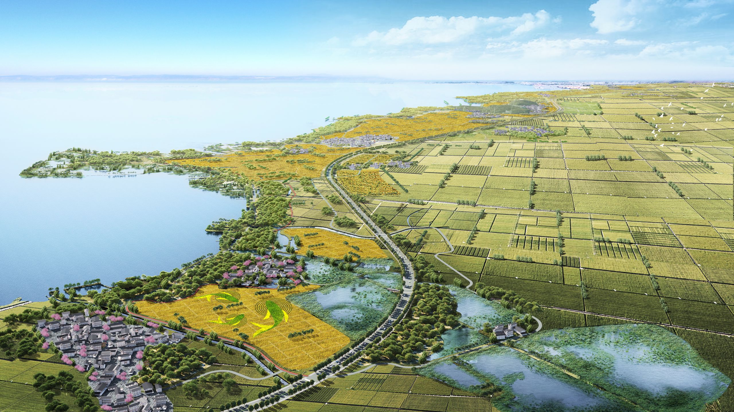
The project is adjacent to the south bank of Dianchi Lake. With the core principle of "jointly protecting the environment and not engaging in large-scale development", it coordinates various ecological elements within the project, takes corresponding restoration measures, and realizes the construction of an ecological security pattern. Among them: the lakeside ecological control zone is to optimize the biological habitat and vegetation patches and enrich biodiversity; the internal crisscrossing water system is to control the emission of pollution sources, enhance the self-purification capacity of the water environment, and comprehensively improve the water quality; the mining damaged and exposed mountains are covered with green to restore the damaged habitat; the existing forest land is to improve the community structure, optimize the forest phase, and improve the environmental benefits.
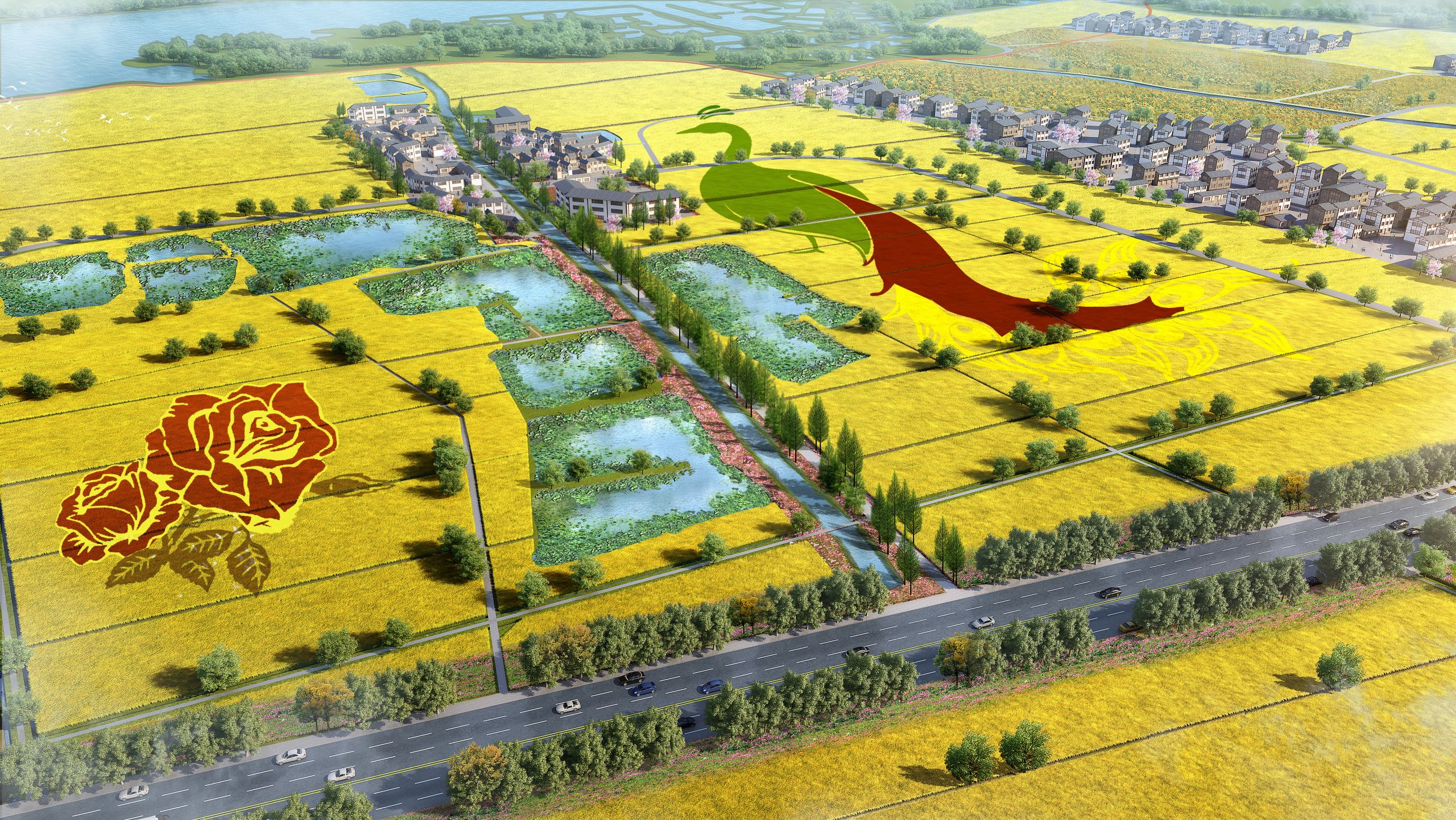
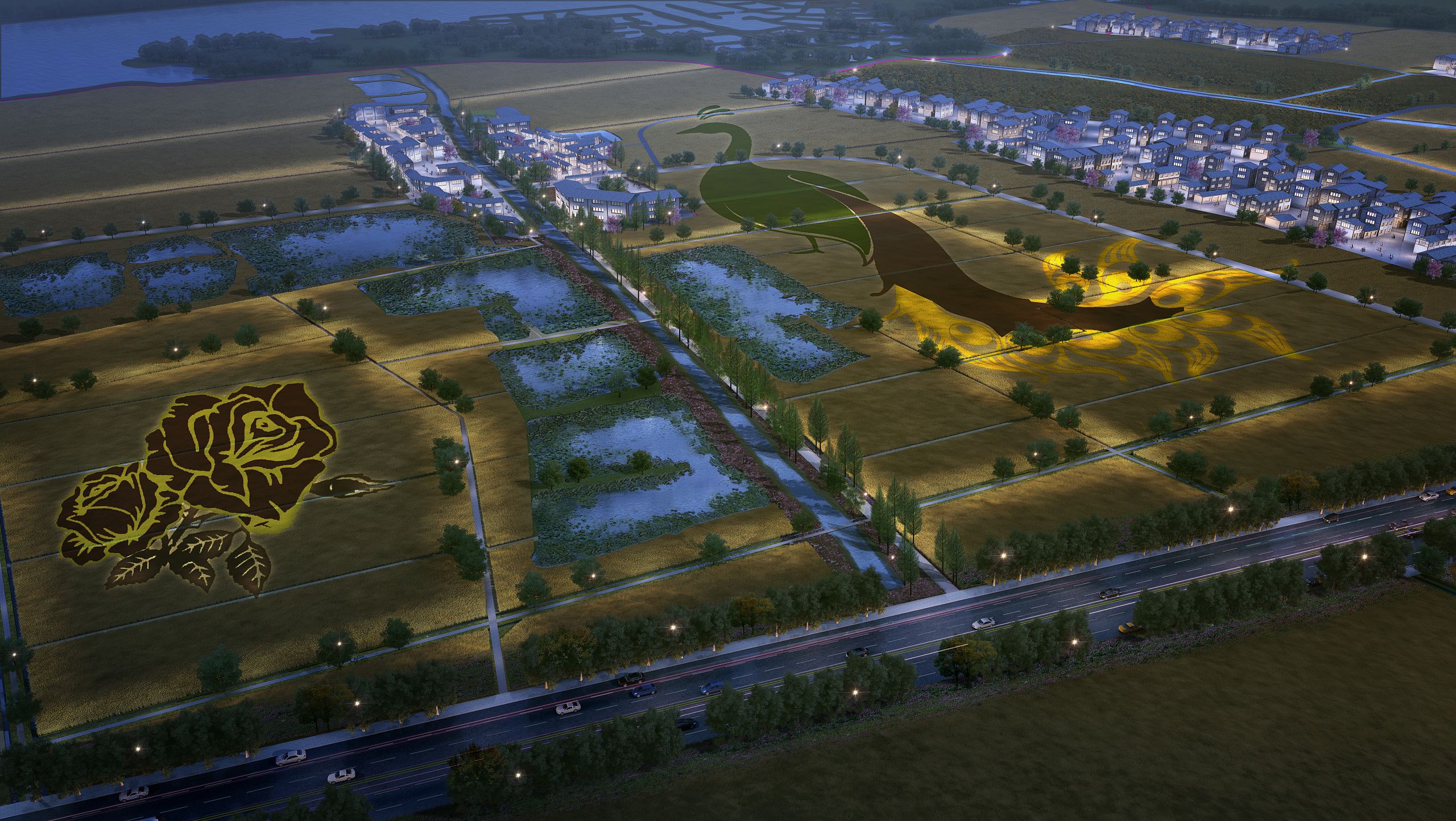
2. Regional space optimization, return to the land farming attributes
All existing greenhouses are demolished, and a multi-crop rotation model is adopted to increase the cultivated land area and improve the quality of cultivated land. At the same time, the combination of agriculture and tourism breaks the single source of income from cultivated land planting, and the farmland base is zoned and planned, which is conducive to the diversification of primary planting and can drive and promote the development of the tertiary industry. On this basis, guide the vigorous development of ecological composite green agriculture and optimize the cultivated land irrigation system to achieve comprehensive governance of agricultural non-point source pollution.
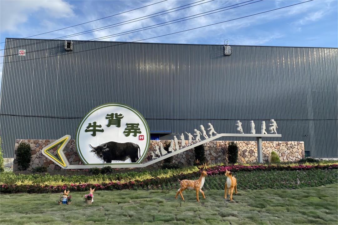
3. Improve the living environment and revitalize the village land resources
According to the current building density and quality, classify the villages and implement targeted "retention, modification, and demolition" measures for each village. At the same time, the existing cultural relics and historical buildings are preserved and protected, the traditional features of regional architecture are inherited, and innovative paths of mixed architectural forms are explored. On the basis of the completion of building repairs, the business formats are upgraded, the diversified values of the countryside are explored, and the village is activated. In addition, the infrastructure is optimized, public service facilities are increased, and the public space, green landscape, and overall appearance of the village are comprehensively improved. Starting from the three aspects of architecture, environment, and facilities, comprehensive improvement and mutual complementation are carried out to ultimately achieve the goal of improving the living environment of the village.
The planning scope covers about 11.1 kilometers along the Huanhu Road on the south bank of Dianchi Lake in Jinning District, with a total planned area of about 1,142 hectares (17,130 mu); the resettlement land is located on the west side of the Yu Ni River in Xinjie District, Jincheng Town, with a total area of about 152 hectares (2,280 mu).
[Highlights of the plan]
1. Prioritize ecological protection and build an ecological security pattern
The project is adjacent to the south bank of Dianchi Lake. With the core principle of "jointly protecting the environment and not engaging in large-scale development", it coordinates various ecological elements within the project, takes corresponding restoration measures, and realizes the construction of an ecological security pattern. Among them: the lakeside ecological control zone is to optimize the biological habitat and vegetation patches and enrich biodiversity; the internal crisscrossing water system is to control the emission of pollution sources, enhance the self-purification capacity of the water environment, and comprehensively improve the water quality; the mining damaged and exposed mountains are covered with green to restore the damaged habitat; the existing forest land is to improve the community structure, optimize the forest phase, and improve the environmental benefits.
2. Regional space optimization, return to the land farming attributes
All existing greenhouses are demolished, and a multi-crop rotation model is adopted to increase the cultivated land area and improve the quality of cultivated land. At the same time, the combination of agriculture and tourism breaks the single source of income from cultivated land planting, and the farmland base is zoned and planned, which is conducive to the diversification of primary planting and can drive and promote the development of the tertiary industry. On this basis, guide the vigorous development of ecological composite green agriculture and optimize the cultivated land irrigation system to achieve comprehensive governance of agricultural non-point source pollution.
3. Improve the living environment and revitalize the village land resources
According to the current building density and quality, classify the villages and implement targeted "retention, modification, and demolition" measures for each village. At the same time, the existing cultural relics and historical buildings are preserved and protected, the traditional features of regional architecture are inherited, and innovative paths of mixed architectural forms are explored. On the basis of the completion of building repairs, the business formats are upgraded, the diversified values of the countryside are explored, and the village is activated. In addition, the infrastructure is optimized, public service facilities are increased, and the public space, green landscape, and overall appearance of the village are comprehensively improved. Starting from the three aspects of architecture, environment, and facilities, comprehensive improvement and mutual complementation are carried out to ultimately achieve the goal of improving the living environment of the village.